The land owned by the Bucklin family next to Rehoboth was larger than the city of Providence
Technically, the Bucklin land was adjoining Rehoboth, not in Rehoboth as Rehoboth existed before the Revolutionary war. (Rehoboth was south and eastward (inland) from the Bucklin property.)
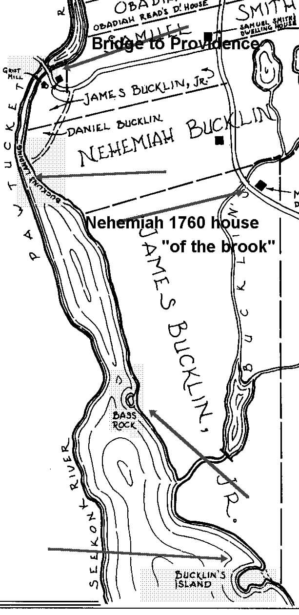 The William Bucklin Succession. The history of the east side of the Pawtucket falls, and the area of commerce for this side of the river, for several generations following, is mainly that of William Bucklin and his descendants. Indeed the early tax records indicate that William (with 600 acres on the north side of Rehoboth) had more land than any combination of three of the earliest settlers of the adjoining Rev. Newman’s Rehoboth. This Bucklin land extended for about 2 miles on the river and a half mile inland. It included the best landing area from the tidal river, the best area for fishing, the major falls, and land both below the falls (the tidal Pawtucket River) and above the falls (the fresh water Blackstone River), as well as salt march for cattle (the marshy area separating the high ground of “Bucklin’s Island” from the farm lands and woods on the east side of the river. and a brook (Bucklin’s Brook) marking the land on the East side.
At the time of the Revolution, the Bucklins had further important land additions to the original Bucklin 600 acres. The land additions included a purchase of the land southward from “Bucklin’s Island” to a river bay/cove where a small river entered by a small falls from the east. At this small falls the second of Bucklin mills was located. (The first was at the Pawtucket falls.) Indeed, if one looked from Providence east across the tidal Pawtucket River, chances are all you would see would be land owned by the Bucklin family.